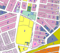

Brisbane City Plan 2014 (City Plan) contains maps showing where provisions of the planning scheme apply across the Brisbane area. City Plan online presents both the mapping and the provisions in an easy to use, single location. Mapping within City Plan online presents zoning, overlays, neighbourhood plans and priority infrastructure plan maps. You should view Brisbane City Plan 2014 mapping in conjunction with the provisions.
Council regularly updates Brisbane City Plan 2014. The Table of Amendments (Appendix 2) lists essential details and further information can be found on Adopted City Plan amendments.
You can navigate a map of Brisbane showing the local government boundaries. To use the tool you can zoom in to suburb and street level. Switch on different maps or layers to see how a property may be affected by Brisbane City Plan 2014. You can view zoning, overlay, neighbourhood plan and priority infrastructure plan maps and generate property reports at the property holding or parcel (lot) level.
The interactive mapping includes Queensland Government state planning policy mapping. This is used where it supersedes Brisbane City Plan 2014 maps, e.g. the Australian Noise Exposure Forecast (ANEF) mapping under the Airport environs overlay.
This mapping is inaccessible to website assistive technologies. Phone Council on 07 3403 8888 for assistance accessing or interpreting any of these maps.
To use Council's City Plan online, you must accept the terms and conditions of this tool. Refer to the user guide for assistance with using this tool.
You can download Brisbane City Plan 2014 neighbourhood plan, zoning and overlay spatial data along with the local government infrastructure plan data. This is available as open data in GIS formats through the Brisbane Open Data website.
Strategic framework maps show Council's vision for long-term land use planning for Brisbane. The Strategic framework maps should not be read at the individual property level. They provide a picture of the city shape at a city-wide scale.
You can view the Strategic framework maps in City Plan online, which displays the current maps and maps in superseded versions back to v14.00/2019. Access Strategic framework maps for earlier versions of City Plan via Adopted amendments.
The basis of all planning starts with zoning. City Plan provides zoning maps for all land within the Brisbane City Council area. Zoning maps are included to show the different zones over land in Brisbane. Zones show how different land uses that are preferred or accepted in an area fit together. Zones can be further divided into precincts.
You can view the zoning in City Plan online interactive mapping, which displays the current zoning and zoning in superseded versions back to v14.00/2019. Access zoning mapping for earlier versions of City Plan via Adopted amendments.
Overlay maps show either Queensland Government interests or where particular local circumstances are relevant to development. The purpose of overlays is to identify areas that:
Within City Plan, overlay mapping relates to overlay codes in Part 8.
You can view all overlays in City Plan online interactive mapping, which displays the current overlays and overlay sub-categories and the superseded overlays and overlay sub-categories back to v14.00/2019. Access overlay mapping for earlier versions of City Plan via Adopted amendments.
Neighbourhood plan maps show the boundary of each neighbourhood plan area, along with any precincts and sub-precincts that may be relevant. Within City Plan, neighbourhood plan mapping relates to the Neighbourhood plan codes in Part 7.
You can view the Neighbourhood plan maps in City Plan online interactive mapping, which displays the current Neighbourhood plan maps and Neighbourhood plan maps in superseded versions back to v14.00/2019. Access Neighbourhood plan mapping for earlier versions of City Plan via Adopted amendments.
The Local Government Infrastructure Plan (LGIP) maps identify the priority infrastructure areas (and associated localities). This includes network keys, network service catchments and desired standards of service areas for the Brisbane Local Government Area.
Within City Plan, LGIP maps are referenced in SC3.2 of Schedule 3.
You can view the LGIP maps in City Plan interactive mapping, which displays the current LGIP maps and LGIP maps in superseded versions back to v14.00/2019. Access LGIP mapping for earlier versions of City Plan via Adopted amendments.
The plans for trunk infrastructure (PFTI) maps identify existing and proposed trunk infrastructure in the schedule of works. These are intended to service the predicted existing and future residential and non-residential development.
Within City Plan, PFTI maps are referenced in s4.5 of Part 4.
You can view the PFTI maps in City Plan online interactive mapping, which displays the current PFTI maps and PFTI maps in superseded versions back to v14.00/2019. Access PFTI mapping for earlier versions of City Plan via Adopted amendments.
Other maps identify long-term infrastructure (LTIP) areas for the Brisbane Local Government Area. They identify infrastructure required to service development beyond the horizon of the LGIP. Long-term infrastructure maps are referenced in Part 10.3 of City Plan.
You can view the LTIP maps in City Plan online interactive mapping, which displays the current LTIP maps and LTIP maps in superseded versions back to v14.00/2019. Access LTIP mapping for earlier versions of City Plan via Adopted amendments.